GRASS GIS crash course

GRASS GIS crash course
November 3rd, 2017
Organized by: OSGeo.NL and ITC
Trainers: Veronica Andreo 1 , Sajid Pareeth 2 and Paulo van Breugel 3,4
1Department of Earth Observation Science. ITC – Faculty of Geo-Information Science and Earth Observation. University of Twente; 2 Water Science and Engineering Department, IHE Delft Institute for Water Education; 3 Geo Media & Design, HAS University of Applied Sciences; 4 OSGeo.nl
With the free availability of petabytes of remote sensing data, global climate models, sensors and other geospatial data there is an urgent need to train potential users in an efficient way of handling and processing big data sets. Over the last decade open source geospatial tools have gained wide popularity and stability, alongside the strong increase in the amount of freely available data.
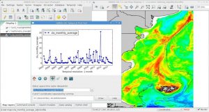
GRASS GIS, born more than 30 years ago, is a powerful free and open source software for spatial analysis. It consists of more than 500 modules (plus hundreds of user add-ons that can extend its functionality) for processing vector, raster, voxel and temporal data. GRASS GIS can serve as a stand-alone desktop GIS, with a modern graphical user interface, as well as the backbone of a GIS infrastructure. It provides interfaces to many other programs in related domains like geostatistics, databases, web map services and other GIS software (e.g., QGIS). GRASS GIS is used in academia, commercial settings and by public authorities all over the world, for a wide range of applications.
Course material
Note: Course has been a succes: full house at ITC 🙂
All the course material (both data and sheets) can be downloaded from:
https://github.com/veroandreo/grass_workshop_itc
Website: http://scientificpubs.com/grass_workshop_itc/index.html
Course objectives
With this course the participants will get an overview of the software capabilities and a hands-on experience in raster, vector and time series processing with the Open Source software GRASS GIS 7.
Course structure/contents
The course consists of mainly practical sessions with a short intro to basic concepts at the beginning. All the code and material will be publicly available**.** We will cover the following introductory topics, among others:
- GRASS database, locations and mapsets
- Working with different data types (vector, raster, 3D raster formats, time series)
- Different interfaces (GUI, CLI, Python)
- Region and mask
- Scripting examples
- Visualization of spatial data; scale bar, symbols, grids, color tables, histograms
- Where to find help
After the introduction with simple examples, we will go together through a guided exercise to demonstrate a full workflow in GRASS GIS, involving raster, vector and temporal data. In the end, participants will have the chance to follow three different tutorials: Remote sensing analysis using satellite data, Time series processing and spatial point interpolation. Teachers will be available for questions and explanations.
Course Audience
The course is oriented to MSc and PhD students as well as early career scientists and lecturers who already have basic knowledge of GIS and RS and are willing to learn a new tool. A maximum of 25 attendees will be accommodated.
When and where?
- Friday, November 3rd, 2017 from 10.30 to 16.30 (with 1-hour for lunch break)
- ITC – Faculty of Geo-Information Science and Earth Observation. University of Twente. Hengelosestraat 99, 7514 AE, Enschede. The Netherlands.
Requirements
- Bring your laptop with GRASS GIS 7.2.2 installed ( download | OSGeo-live)
- Links to sample data will be provided shortly.
Registrations
If you want to participate, please register via Meetup or send an email to paulo@osgeo.nl [Update: maximum number of participants has been reached, registration closed].